Pixel Matching/Mosaics

This map highlights environmental or land-cover changes over time by combining and aligning imagery from Landsat 5 (1984–2011) and Landsat 7 (1999–present) satellites. Using advanced pixel-matching techniques, I harmonized the datasets to ensure consistent comparisons across different sensors and time periods.
Surface Classifications
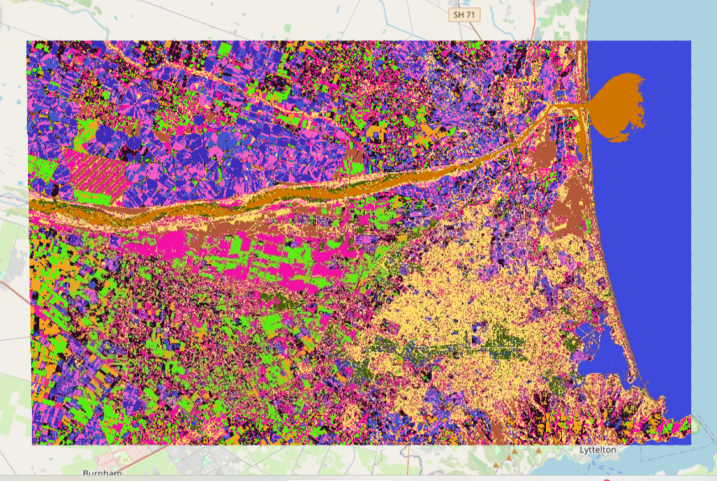
Unsupervised land cover classification of Canterbury, New Zealand (172.2°E, -43.6°N to 172.8°E, -43.35°N) derived from Sentinel-2 imagery (13 February 2017) using k-means clustering (WEKA workbench, University of Waikato). Colors represent distinct surface type clusters identified through automated pattern recognition
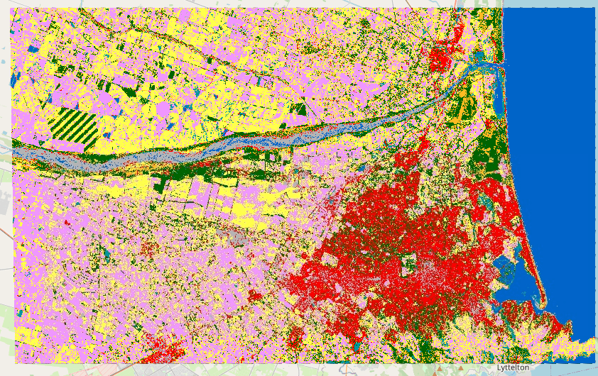
Sentinel-2-derived land cover map of Canterbury, NZ (2017) classified via Random Forest using ESA WorldCover training data. Colors denote 11 surface classes including vegetation, water, and anthropogenic features
Image Comparasion
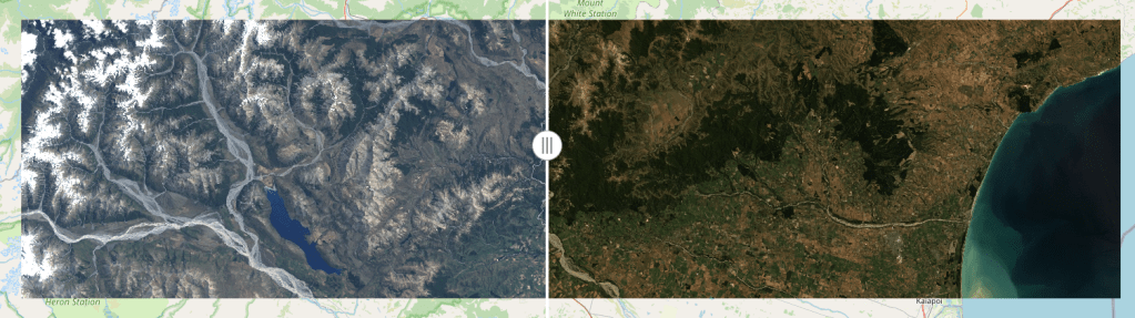
Two side by side images with a interactive slider to view the difference in atmospheric correction. Could also be used as a before and after image.
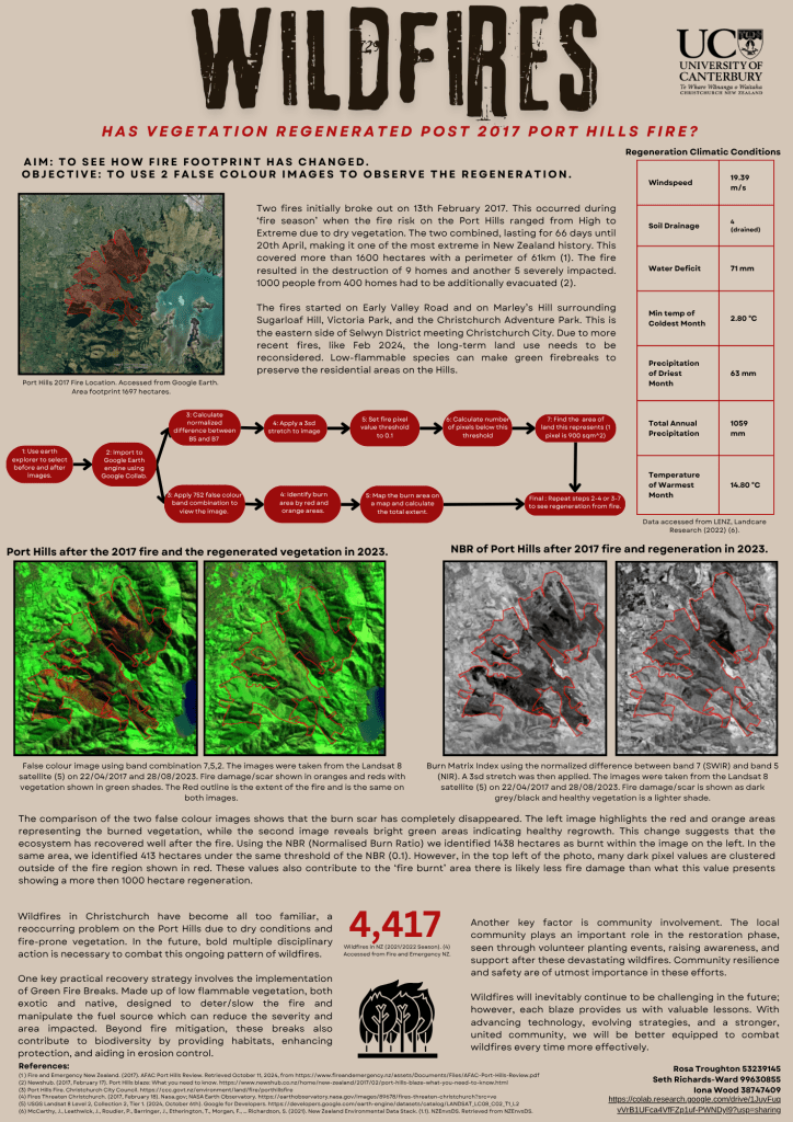
Wildfire Regeneration