Metashape
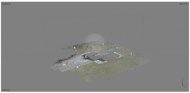
Sparse point cloud of the Ilam football building (Christchurch, NZ) generated from 28 drone photos using Metashape’s Structure-from-Motion workflow. Nine control points (labeled) anchor the georeferenced model.


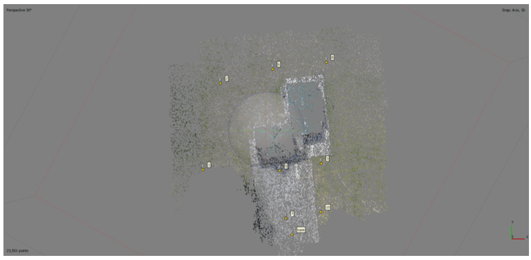
High-density point cloud of Ilam football building reconstructed from 28 drone images using Metashape. Color represents RGB values from source imagery, with point spacing of 1.2 cm. Control points (1-8,10,base) ensure georeferencing accuracy

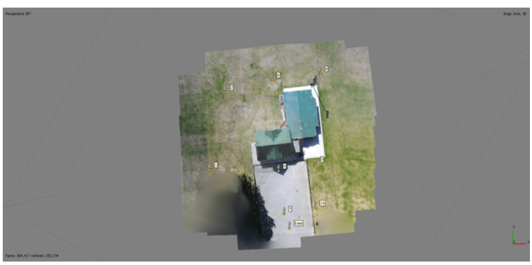
Textured 3D mesh model (5.3M faces) derived from the dense point cloud, showing complete structural features.

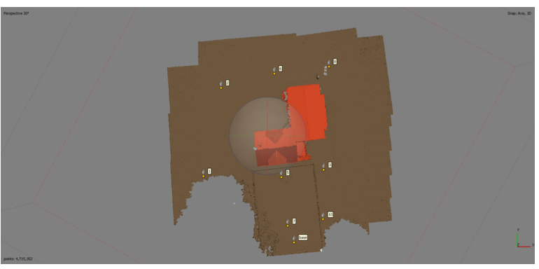
Classification of photogrammetric point cloud (Metashape) showing ground (brown), building (red), and unclassified points (grey) at Ilam football building. Derived from 28 drone photos, georeferenced using 9 control points (labeled). Classification enables terrain modeling and feature extraction
Final Product (Using ArcGIS)
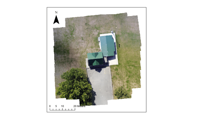
Orthorectified map of the football building at Ilam Fields, Ilam, New Zealand, displayed in true color. The map is oriented with north at the top, and the scale in the bottom-left corner shows 0, 5, 10, and 20-meter increments. This model was created from 28 drone-captured photos, processed into a 3D mesh in Metashape, and integrated into an ArcGIS map for accurate spatial representation.
